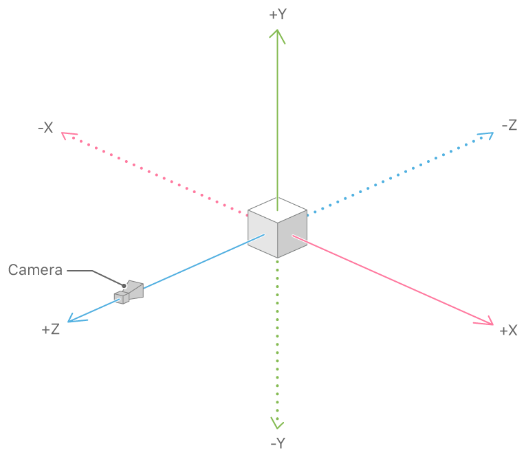
ARKit uses visual-inertial odometry (VIO)
About Augmented Reality and ARKit | Apple Developer Documentation
About Augmented Reality and ARKit | Apple Developer Documentation

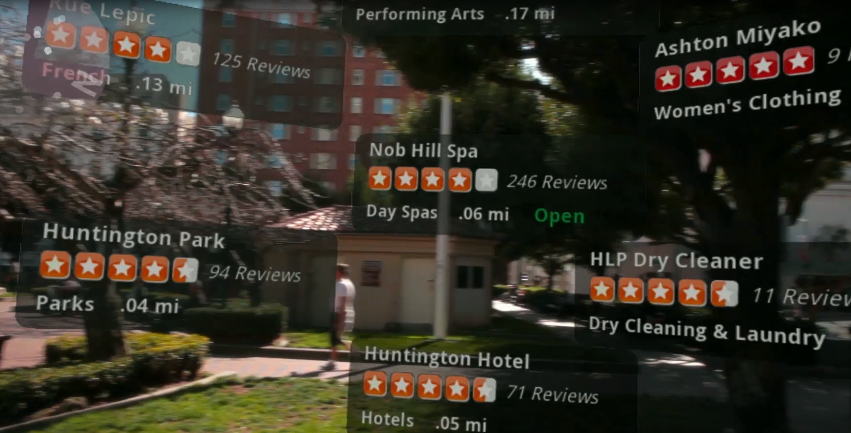
Discover supporting concepts, features, and best practices for building great AR experiences.
Source: developer.apple.com/documentation/arkit/about_augmented_reality_and_arkit